

Now Reading: How Hurricanes Like Erin Spawn Distant Rip Currents
1
-
01
How Hurricanes Like Erin Spawn Distant Rip Currents
Fast Summary
- Hurricane Erin,a Category 2 storm,is moving past the Bahamas and heading toward the Carolinas before veering into the Atlantic. Its eye is unlikely to approach closer than 300 miles to U.S. shores.
- Despite its distance, much of the U.S. East Coast, from Miami to Maine, faces moderate or high risks of rip currents due to wave disruptions caused by hurricane activity.
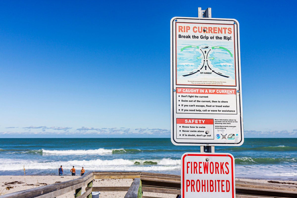
- Rip currents are formed when breaking waves along coasts push water onto shore; this water flows back into the sea via narrow channels in sandbars or underwater topography.
- Distant hurricanes intensify rip currents through large waves generated by their sustained winds over expansive areas and slow movement across oceans.
- Risks from Erin’s rip currents could persist through this week and weekend. beachgoers are advised not to swim at affected locations unless lifeguards are present and warnings are obeyed.
- Safety tips include following local advisories and employing “flip, float, follow” if caught in rip currents rather than swimming directly against them.
Images:
- A NOAA map highlighting high-risk zones for life-threatening rip currents on august 18-19 along the U.S. east Coast (currentformationdiagram.jpg”>Image Source: Gary Hincks/Science source).
- Satellite imagery showing Hurricane Erin’s path on August 18 (Read More
Indian Opinion Analysis
The distant effects of Hurricane Erin highlight how phenomena far offshore can still pose serious risks for coastal regions globally-including India’s extensive shoreline during its cyclone seasons in June-November every year.For beachside communities reliant on tourism or fishing industries across India-from Goa’s coastlines to Odisha’s cyclone-prone beaches-surf safety education remains crucial as unpredictable strong marine forces may lead swimmers astray without warning systems akin issued east-coast perilous riptiders tagging


Related Posts


Stay Informed With the Latest & Most Important News
Previous Post
Next Post


Donations


Advertisement

Loading Next Post...


.</li>
<li>A diagram explaining how underwater topography aids in forming rip currents (<a href=)
.</li>
</ol>
<p><a href=)