

Now Reading: NASA Maps Plankton Crucial for Feeding Right Whales
-
01
NASA Maps Plankton Crucial for Feeding Right Whales
Swift Summary
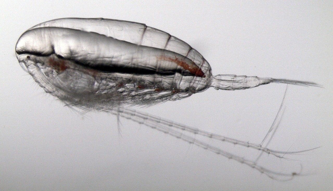
- North atlantic right whales,a critically endangered species with approximately 370 individuals left,rely on tiny zooplankton called Calanus finmarchicus as their primary food source.
- Scientists have developed a method to track these plankton using NASA satellite data, specifically by detecting the reddish pigment of the plankton that alters ocean color patterns.
- The method employs the Moderate Resolution Imaging Spectroradiometer (MODIS) from NASA’s Aqua satellite to identify and estimate concentrations of Calanus.
- This approach could help predict whale feeding grounds and reduce risks like vessel collisions and fishing gear entanglements, enhancing conservation efforts and benefiting maritime industries.
- challenges include cloud cover, rough seas, misidentification of othre small red organisms, and MODIS nearing its end-of-life; however, NASA’s next-generation PACE satellite launched in 2024 is expected to provide improved capabilities.
- Local expertise on seasonal plankton behavior remains key for interpreting this data effectively for decision-making purposes.
Indian Opinion Analysis
The innovative use of satellite technology to track crucial marine ecosystems highlights an vital intersection of space science and environmental conservation.While this development primarily concerns the Gulf of Maine region in North America, its implications resonate globally-including India-where marine biodiversity is vital both ecologically and economically.
India’s vast coastline supports millions through fisheries while hosting diverse marine life facing challenges such as overfishing or habitat loss due to climate change.Applying similar remote sensing tools tailored for Indian waters could aid in tracking ecosystems like mangroves or coral reefs that are integral to fisheries or endangered species like dugongs.
The challenge showcased in balancing maritime industries with ecological priorities also aligns with India’s need for enduring management practices amidst expanding economic activities along its coasts (e.g., ports). As organizations like ISRO develop Earth observation systems akin to PACE’s capabilities,adapting such methods locally could enhance India’s marine resource governance while promoting biodiversity protection aligned with global goals like SDG 14 (Life Below Water).


Related Posts


Stay Informed With the Latest & Most Important News
Previous Post
Next Post


Advertisement


