

Now Reading: Satellite Images Reveal Grand Canyon Wildfires Spreading Over Thousands of Acres
-
01
Satellite Images Reveal Grand Canyon Wildfires Spreading Over Thousands of Acres
Satellite Images Reveal Grand Canyon Wildfires Spreading Over Thousands of Acres
Speedy Summary
- Two wildfires in Northern Arizona, sparked by lightning, have burned over 60,000 acres in more than a week, including areas of the Grand Canyon.
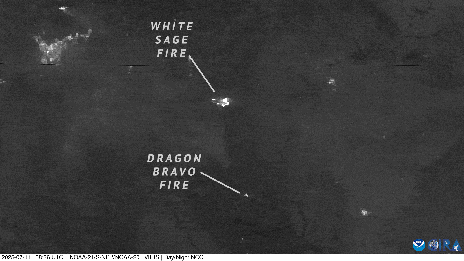
- The first fire, Dragon Bravo Fire (started on july 4), impacted grand Canyon National Park and destroyed structures like the Grand Canyon Lodge.
- The second fire, White Sage Fire (initiated on July 9), spread rapidly due to dry weather and strong winds.
- Satellites from NOAA – the Geostationary Operational Environmental Satellite (GOES) and Joint Polar Satellite System (JPSS) – are aiding firefighting efforts by tracking fire growth and smoke dispersion in real-time using tools like Advanced Baseline Imager and Visible Infrared Imaging Radiometer Suite.
- These satellite systems provide nighttime imaging capabilities to monitor wildfire progression even after sunset.
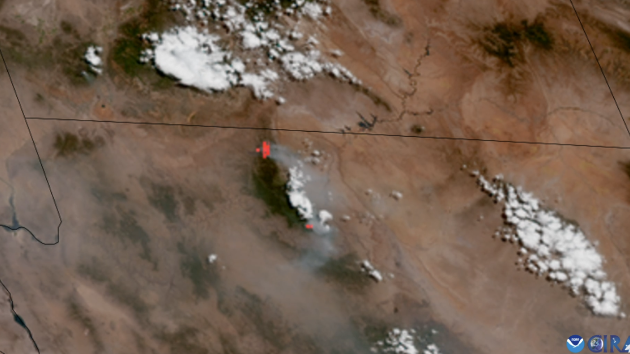
!Two wildfires over the Grand Canyon
Image credit: NOAA
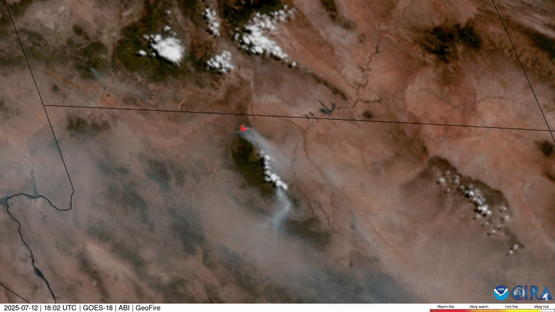
!Time-lapse showing wildfire smoke progression during daytime
Image credit: NOAA
!Nighttime view of fires from space
Image credit: NOAA
Indian Opinion Analysis
The utilization of advanced satellite technology to combat natural disasters highlights how science can assist policymakers worldwide. For India-a country susceptible to forest fires during seasons of high heat-similar reliance on remote sensing via satellites could be a useful strategy for disaster management. Tools such as real-time imaging and spectral bands can complement ground efforts during major emergencies like Uttarakhand forest fires or other regional challenges annually caused by extreme weather.
Moreover, this incident underlines the importance of international collaboration with agencies such as NOAA for best practices in wildfire surveillance technology that might benefit india’s Ministry of Habitat or domestic climate initiatives.Given India’s vast ecological reserves that face increasing risks tied to global warming and unpredictable rain patterns,integrating advanced technologies into national preparedness plans is critical for preserving biodiversity while ensuring human safety amidst climate-driven challenges.


Related Posts


Stay Informed With the Latest & Most Important News
Previous Post
Next Post


Advertisement


