

Now Reading: Australia’s newest Great Walk on Flinders Island reveals a forgotten story of survival
-
01
Australia’s newest Great Walk on Flinders Island reveals a forgotten story of survival
Australia’s newest Great Walk on Flinders Island reveals a forgotten story of survival
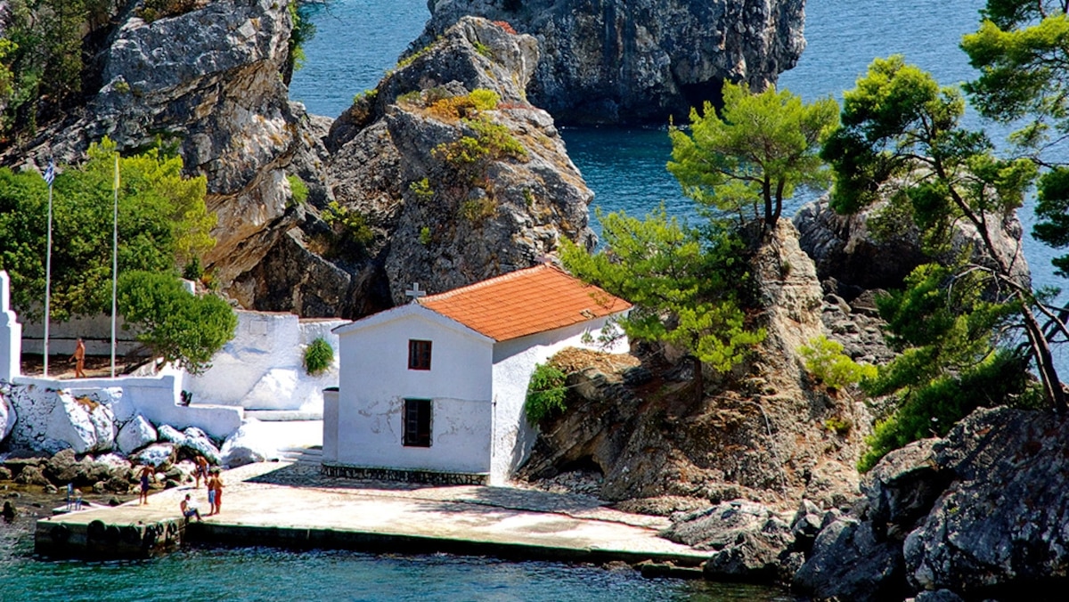
The aquamarine water is so clear and warm it could be in the Caribbean, and the white silica beaches framed by granite boulders are reminiscent of the Seychelles. The giveaway is the tangerine lichen spattered on the rocks—a clear sign that this is the Australian island state of Tasmania (Lutruwita).
But this isn’t the Bay of Fires (Larapuna), famed for the magnificent contrasting hues of its coastal landscape. I’m on Flinders Island, a remnant of the submerged plain that once formed a land bridge across the notorious Bass Strait from Tasmania to mainland Victoria.
“Flinders Island is like the Bay of Fires on steroids,” says Tasmanian-born wilderness guide Gracie Hartshorn. She co-leads our group of nine alongside Liam McGuire, from Canberra, on the Flinders Island Walking Adventure, which in 2024 was named Australia’s 13th Great Walk.
A Great Walk in Australia is a multi-day guided walking experience that immerses travelers in the country’s wilderness areas. These walks are designed to be eco-luxury and comfortable. Experienced guides lead small groups on these walking adventures that usually include gourmet food, wine, and comfortable accommodations.
As we set off for the first leg of our 26-mile adventure, along a deserted beach under sapphire skies, I note the island also receives far fewer tourists than its mainland doppelganger.
(Related: What it’s like to hike Australia’s Great Ocean Walk.)
Lonely island
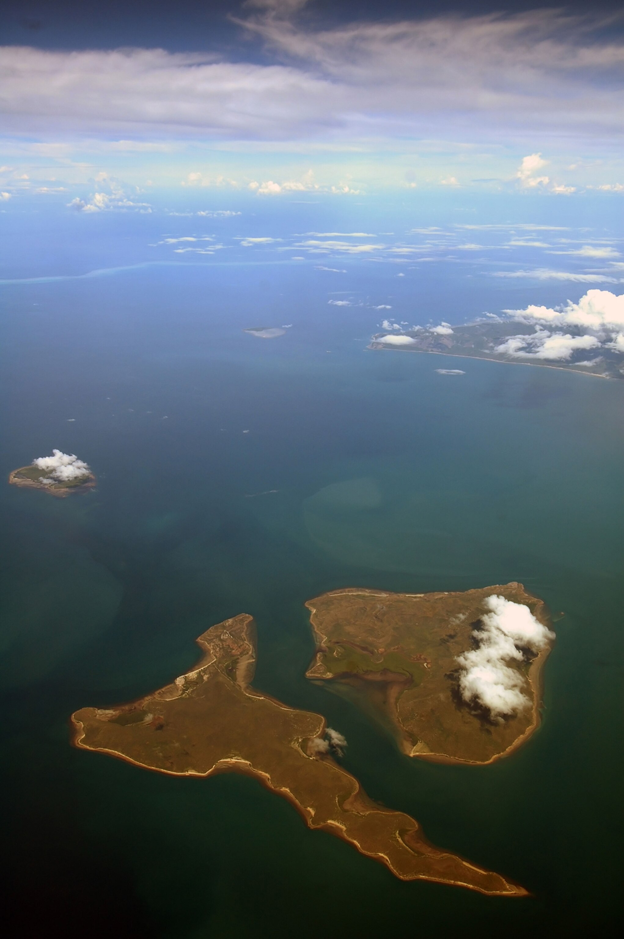
This Aerial view shows the remote Stanley Island (left) and Flinders Island (right), home to important Aboriginal sites, including Wybaleena, also known as the “Aboriginal Settlement.”
Photograph by Suzanne Long, Alamy Stock Photo

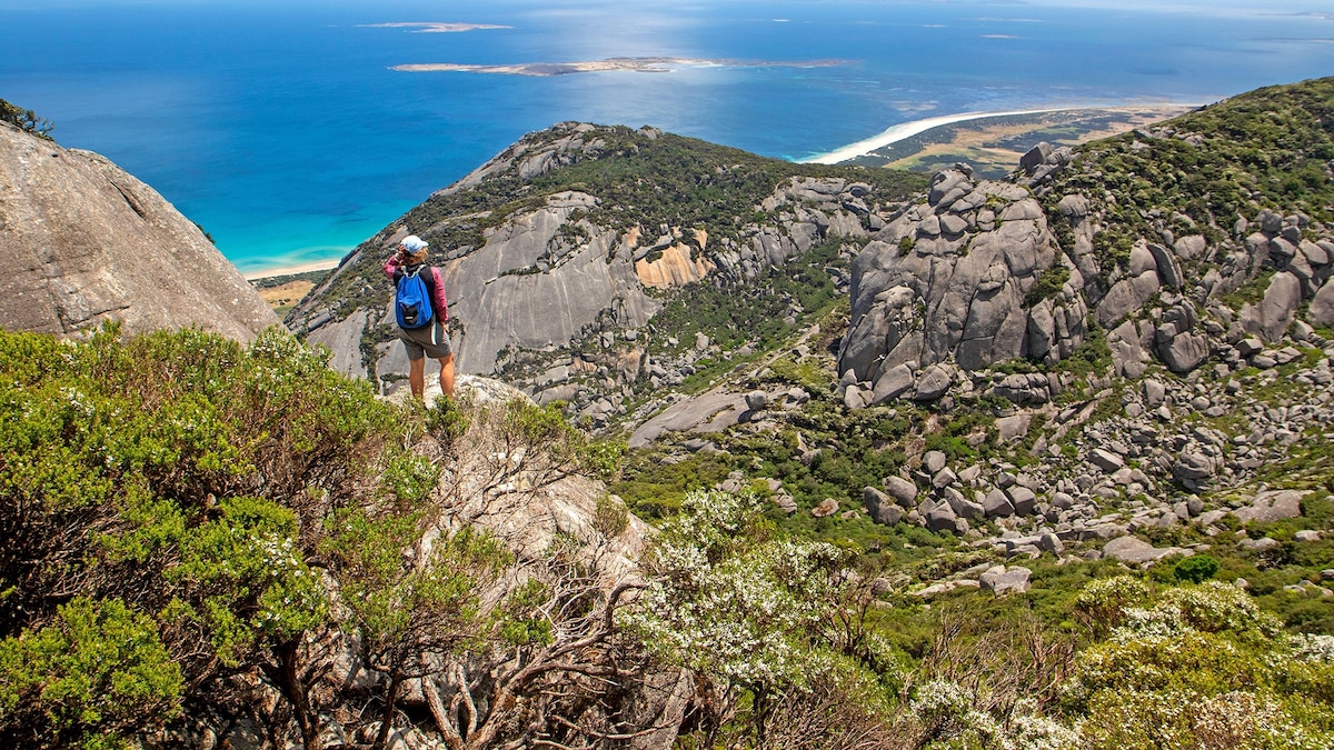
Hikers climb to the top of the 2,566-foot-tall Mount Strzelecki, the highest peak on Flinders Island.
Photograph by Andrew Bain, Alamy Stock Photo
Named by British explorer Matthew Flinders during his 1801 to 1803 circumnavigation of Australia, our 515-square-mile island home for the next six days and five nights is characterized by lonely beaches, rolling cattle pastures, and hulking mountains including the granite massifs of Strzelecki National Park at its southern end. Most of its roads are unsealed and wallabies outnumber locals. The island’s remoteness makes it one of Australia’s best-kept travel secrets, accessible only via a 30-minute small-plane charter flight or an eight-hour journey on the weekly barge from Bridport on mainland Tasmania.
Based at an exclusive “eco-comfort camp” nestled in coastal bushland, the walking adventure traces the island’s most scenic trails offering a mix of terrain, vistas, wildlife spotting, and cultural history. Day two takes us on a rollicking seven-mile loop around Mount Killiecrankie (1,037 feet), where wind- and rain-sculpted boulders resemble a giant wombat (the island is home to its own subspecies) and an old man’s face. Yellow-throated honeyeaters chatter in the eucalyptus trees while wallabies keep the beat with the thump-thump of their outsized feet as we hike towards Stacky’s Bight, an idyllic, protected cove made for a lunchtime swim.
Infectiously cheerful camp host Tahli Sanders welcomes us back each night with a hearty evening meal starring beef and lamb sourced from local farmers, island-made condiments, and native ingredients including saltbush. “We’re as eco-friendly here as we can be,” he says, firing up the barbecue. Later, I drift off watching satellites track across the star-spangled southern sky through the see-through roof of my dome tent.
(Related: How this photographer got the photo of her dreams in Tasmania.)
Forgotten history
During a bushwalk on the ragged Darling Range at the island’s heart, Liam explains how Palawa/Pakana (Aboriginal Tasmanians) managed the landscape with firestick farming long before European farmers arrived. “Firestick farming is when land is purposely burnt to encourage fresh growth and create the perfect hunting ground,” he tells us.
The island’s original Aboriginal inhabitants, we learn, mysteriously ceased to be full-time occupants around 4,000 years ago. While cultural living sites can still be found across the 52 islands of the Furneaux Group, the most significant site is linked to more recent residents.
“This is the site of an attempted cultural genocide,” announces Hartshorn upon our arrival at the former Aboriginal settlement of Wybalenna, where a red brick chapel rises from a barren, windswept corner of the west coast.
(Related: Why Aboriginal Australians are still fighting for recognition.)
Following a series of brutal frontier conflicts in Tasmania, the Palawa/Pakana population decreased from approximately 15,000 upon colonization in 1803 to around 300 by the early 1830s. Englishman and “Aboriginal conciliator” George Augustus Robinson convinced most of the survivors to resettle on Flinders Island in 1833. “He promised that they would be safe and could continue their culture there,” Hartshorn says.
The reality was anything but, explains cultural educator Trish Hodge, a descendant of Mannalargenna, a clan leader and warrior who died at Wybalenna.
“Once they arrived there, he [Robinson] pretty much immediately ruled out cultural practices,” Hodge tells me. “They weren’t allowed to have their ceremonies or speak their language. Their names were changed, and they were forced to go to church.”
Compounded by horrific living conditions (survivor Fanny Smith told of being flogged, chained up, and forced to sleep in a box), the settlement’s population had dwindled to just 47 when it was abandoned in 1847. Survivors including Truganini, storied incorrectly as the “last Aboriginal Tasmanian,” were relocated to the mainland. In a cemetery near the chapel, at least 107 Palawa/Pakana remain buried in unmarked graves.
“It’s an incredibly sad place, but it’s also a powerful symbol of resilience,” says Hodge. “I was taught in school that we didn’t exist. But we are still here, and our community is still strong.”
(Related: Australia hands control of its newest national parks to Indigenous peoples.)
Island life today
The release of freehold land on Flinders Island in the late 19th century took the island in a new direction as “freemen” (free settlers and ex-convicts) arrived to build a life here. Even today, many locals in the tight-knit farming community—numbering around 1000—can trace their ancestry to convicts and shipwrecked sailors.

On the Flinders Island Great Walk, hikers and walkers can explore the island’s beautiful landscape, its dark history, and the resilience of the Tasmanian Aboriginal community.
Photograph by Andrew Bain, Alamy Stock Photo
After a rewarding scramble to the summit of Mount Strzelecki (2,566 feet), the island’s highest peak, on our fifth day, we stop by the tiny main town of Whitemark for a celebratory drink at the historic Flinders Interstate Hotel. I pull up a stool beside Alan Wheatley, a local of 73 years, who tells me that his grandparents settled here after sailing up from Hobart (Nipaluna) with his parents in the 1920s and couldn’t get back.
At Bowman’s Store, established in 1921, I meet fourth-generation islander Claire Bowman, who recently moved back to the island with her young family after 16 years away. “When I had kids, I wanted them to enjoy the same childhood as I did, surrounded by nature,” she says.
Diving into the gin-clear waters of Trousers Point Beach after our final walk of the trip, a mile-long meander around a lichen-encrusted headland backdropped by Mount Strzelecki, it’s easy to understand the appeal of living on an island where the Tasmanian wilderness provides the entertainment. Between its staggering natural beauty and rich history alone, it’s an incredible place simply to walk in.
(Related: A culinary guide to Tasmania’s Huon Valley, from apple pie to agritourism.)
How to do it

Castle Rock, the prominent granite boulder on the eastern coast of Flinders Island, is a short walk from a nearby car park. It is one of many sights that hikers and walkers may see on one of Australia’s accessible Great Walks in various national parks and natural areas.
Photograph by Alexander Cimbal, Alamy Stock Photo
Trails on this Great Walk adventure—all of which are accessible to independent walkers—are graded easy to moderate, and you should be fit to hike up to seven hours per day. Independent walkers should understand that the logistics behind planning a hike like this one on your own can be daunting. All 13 Great Walks have a single operator and are designed to offer an exclusive guided wilderness walking experience that you can’t get anywhere else.
This trip was created with the support of Tasmanian Expeditions/World Expeditions.
Travel with National Geographic to Australia to explore the Daintree Forest with an indigenous guide, and see fairy penguins on the beaches of Bicheno, Tasmania. Click here for more information.
Sarah Reid is an award-winning Australian freelance travel writer specializing in adventure and regenerative travel. Follow her on Instagram @sarahreidtravels.


Related Posts
Stay Informed With the Latest & Most Important News
Previous Post
Next Post


Advertisement


