
Now Reading: Could a Massive Earthquake Cause California to Partially Sink?
-
01
Could a Massive Earthquake Cause California to Partially Sink?
Fast Summary
- A new study highlights potential flooding risks in the Pacific Northwest due too combined effects of sea-level rise and subsidence from major earthquakes in the Cascadia subduction zone.
- Sea levels along northern California, Oregon, and Washington State are predicted to rise by 1.3-2.9 feet by 2100 due to climate change; magnitude 8 or higher earthquakes could cause coastal land to sink by up to 6.5 feet suddenly.
- Research shows earthquake-driven subsidence today could expand floodplains by 115 square miles, while future scenarios with sea-level rise (by 2100) increase flooded areas up to 145 square miles-triple the current flood-prone area.
- large undersea quakes may trigger devastating tsunamis up to 30 feet high, with subsidence further altering floodplain geography after tsunami impacts end.
- Municipal planners may need strategies for protecting infrastructure like bridges, roadways, wastewater systems, and residential properties now projected susceptible to frequent flooding post-disasters.
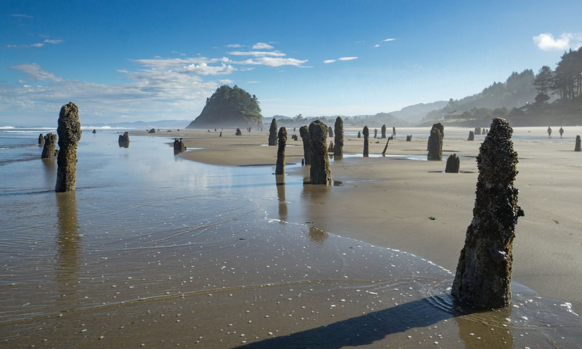
Image Description: Stumps of Sitka spruce drowned during an earthquake-induced coastline drop some 1,600 years ago in Neskowin, Oregon.
Indian Opinion Analysis
The research offers critical insights into disaster preparedness for regions prone to seismic activity-a concern relevant globally but especially significant for India given its vulnerability in Himalayan and coastal regions where tectonic activity is present. While India does not face threats identical to those described here (such as Cascadia’s subduction patterns), studies like this highlight the broader importance of integrating geological risk factors with climate change resilience planning into urban infrastructure growth.
For Indian policymakers and municipal planners facing analogous risks from rising seas and earthquakes near populous cities like Mumbai or Kolkata-or rapidly expanding mountain towns-advanced mapping technologies coupled with predictive models can definitely help mitigate future disasters through informed zoning decisions or reinforced construction standards.
With proper data adaptation strategies akin to those employed in such studies abroad-and investments focused on areas at risk-India too could better safeguard millions while considering long-term environmental shifts indirectly tied across scales globally.Read More


Related Posts
Stay Informed With the Latest & Most Important News
Previous Post
Next Post


Advertisement


