Now Reading: How do clouds get their shapes?
-
01
How do clouds get their shapes?
How do clouds get their shapes?

Get the Popular Science daily newsletter💡
Breakthroughs, discoveries, and DIY tips sent every weekday.
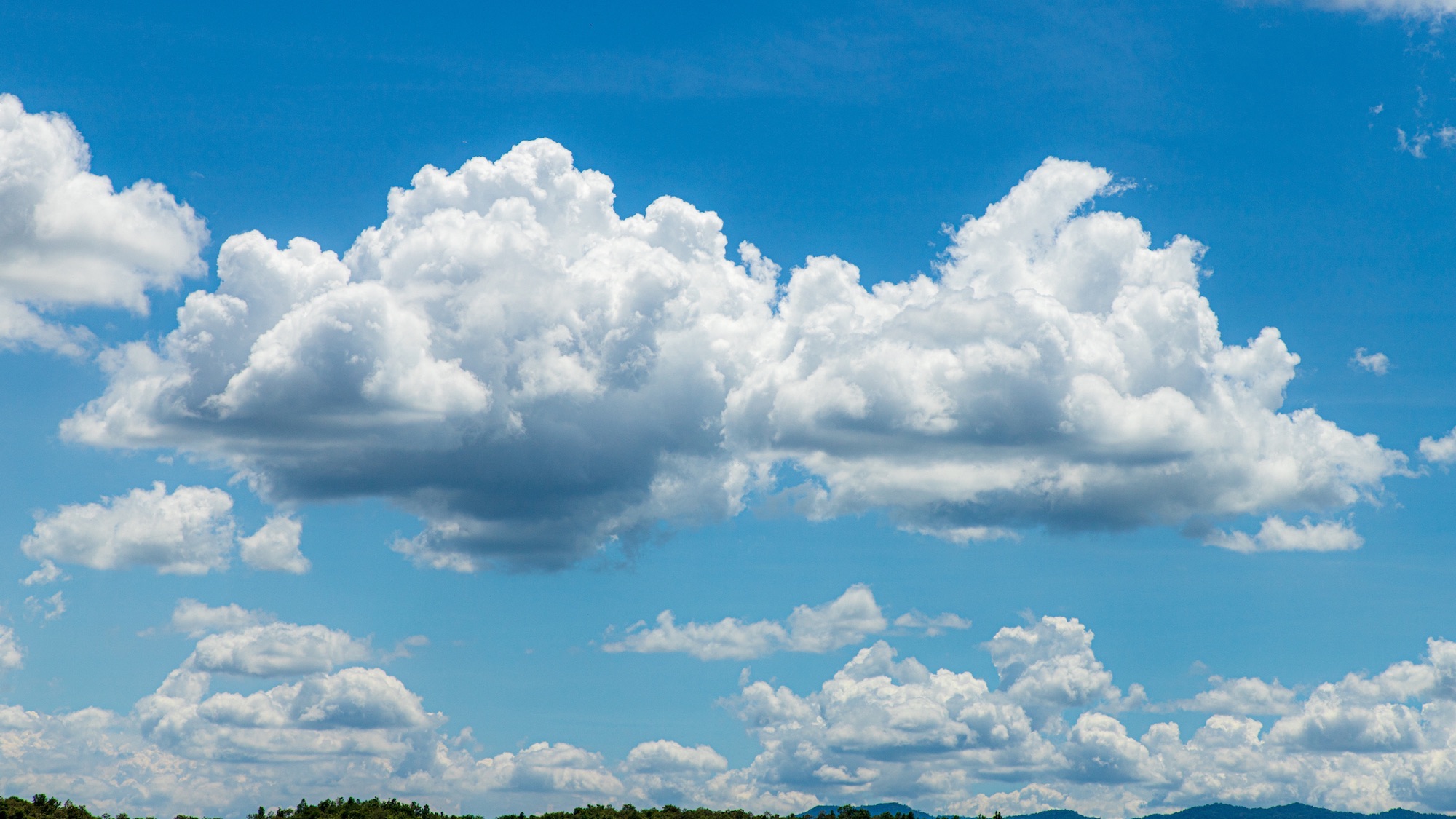
Take a look at the sky on any given day and you’ll likely see clouds of different shapes — some look like cotton balls, others are fine and feathery or tall and imposing. But what gives a cloud its distinct appearance? The answer lies in a mix of factors.
To understand how clouds get their shape, it helps to understand the basics of how they form. When air rises and cools, the water vapor it holds condenses into tiny water droplets or ice crystals. If enough of these particles cluster together, a visible cloud forms.
Scientists typically classify clouds into ten main types, based on their shape and how high they appear in the sky. For instance, cumulus clouds (from the Latin for “heap”) resemble a pile of cotton balls, while stratus clouds (meaning “layer”) stretch out like blankets and cirrus clouds (Latin for “hair”) look feather-like. These root names can be combined to describe more complex cloud types—like cirrocumulus. The prefix “alto” (meaning “high”) helps distinguish mid-level clouds from their lower-level counterparts (such as altostratus vs stratus).

The distance of a cloud from the Earth has a big influence on its appearance. Air temperatures decrease with altitude, so clouds that form closer to earth are made mostly of water droplets, while higher clouds tend to be composed of ice crystals. Mid-level clouds often contain a mix of both. This difference in composition influences how clouds look: water-based clouds, like cumulus, have crisp edges and a solid appearance, while icy clouds, such as cirrus, are usually more transparent and diffuse.
Air movement also affects cloud shapes. As warm, moist air rises—a process known as convection—it cools and condenses, forming clouds. But something interesting happens in the process: as water vapor condenses, it releases heat, which warms the surrounding air. The warmer air becomes less dense than the surrounding cooler air, making it more buoyant. This increased buoyancy causes the air parcel to rise even faster.
“These upward currents are associated with billows, giving the cumuliform clouds that many of us picture when we think of clouds,” Bjorn Stevens, a climate scientist and managing director of the Max Planck Institute for Meteorology in Hamburg, Germany, told Popular Science. If the air is warm and humid near the Earth’s surface but much colder higher up, a fair-weather cumulus cloud can quickly grow into a towering cumulonimbus—the kind that brings thunderstorms.
Cirrus clouds, known for their wispy, feathery appearance, are shaped by strong winds high in the atmosphere. These winds act on the ice crystals that make up cirrus clouds, twisting and spreading them into delicate strands.
“The shape also depends very much on the light,” adds Stevens. He explains that clouds are a “dispersion,” meaning that they’re made up of countless particles suspended in air—more like fog than a solid object. “They don’t have a clear end or beginning,” he says. What we perceive as a cloud’s edge is actually where sunlight scatters off the droplets or ice crystals within. Sometimes this scattering happens near the cloud’s surface, while other times it comes from deeper within the mist, which is why cloud boundaries often seem vague or ever-shifting.

The physical features of an area, or the ‘topography,’ can also influence the shape of clouds. In an article published on The Conversation, Ross Lazear, an instructor in Atmospheric and Environmental Sciences at the University at Albany, State University of New York, explained how air flowing over mountain ranges sets off atmospheric ripples, much like a rock disrupting water in a stream, and leads to the formation of lenticular clouds, which resemble flying saucers.
Each cloud is shaped a certain way for a reason. For meteorologists, those shapes aren’t just fascinating—they’re valuable clues for forecasting what weather is coming next.
his story is part of Popular Science’s Ask Us Anything series, where we answer your most outlandish, mind-burning questions, from the ordinary to the off-the-wall. Have something you’ve always wanted to know? Ask us.

More deals, reviews, and buying guides
The PopSci team has tested hundreds of products and spent thousands of hours trying to find the best gear and gadgets you can buy.


