


Now Reading: Hurricane Erin Set to Bring 100-Foot Waves to East Coast, Warn Forecasters
-
01
Hurricane Erin Set to Bring 100-Foot Waves to East Coast, Warn Forecasters
Swift Summary
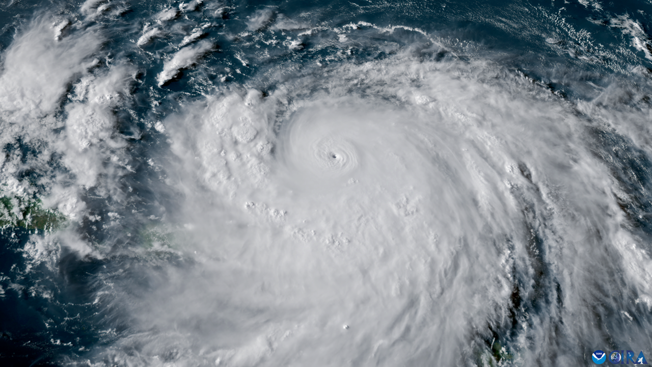
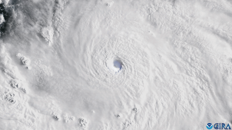
- Hurricane Erin has rapidly intensified into a Category 4 hurricane wiht sustained winds of 130 mph (215 km/h) after briefly reaching Category 5 status.
- The storm, located east of the southeastern Bahamas, poses no immediate threat to landfall but is expected to bring life-threatening surf, rip currents, and flooding along the U.S. East Coast, Bermuda, Bahamas, and Atlantic Canada this week.
- Mandatory evacuation orders have been issued in Dare County’s Hatteras Island (North Carolina), with coastal flood warnings impacting the Outer Banks beginning Tuesday (Aug. 19).
- Forecasters warn waves could reach up to 100 feet (30 meters) due to wind-driven energy propelled by Erin’s size and strength.
- The storm’s rapid intensification reflects a broader trend of stronger hurricanes fueled by rising sea surface temperatures linked to climate change.
Indian opinion Analysis
Hurricane Erin underscores growing concerns about rapidly intensifying tropical cyclones globally. While it directly impacts areas like the U.S.’s East Coast or Atlantic nations such as Bermuda,its scale highlights vulnerabilities for densely populated coastal regions globally-India included. Rising ocean temperatures that contribute to storms like Erin are also an issue for India’s coastline prone to cyclones from the Bay of Bengal and Arabian Sea.
India should view such events as indicators for preemptive climate resilience measures in urban planning and disaster management systems as part of its adaptation strategy amid global warming trends. International collaboration on climate action holds crucial potential as natural disasters no no borders.


Related Posts
Stay Informed With the Latest & Most Important News
Previous Post
Next Post


Advertisement


