


Now Reading: ISRO Starts Countdown for NISAR Satellite Launch
-
01
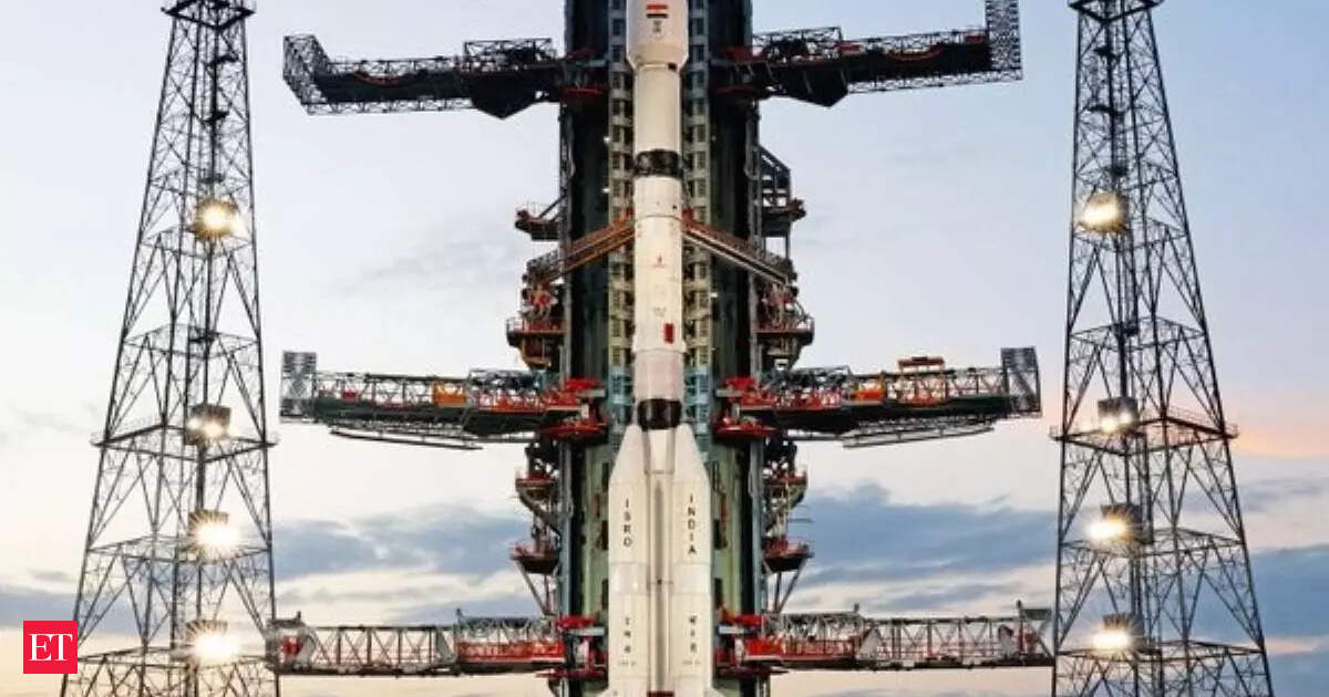
ISRO Starts Countdown for NISAR Satellite Launch
Fast Summary
- Countdown Initiated: ISRO began the countdown at 2:10 pm on Tuesday for the NASA-ISRO Synthetic Aperture Radar (NISAR) satellite launch.
- Launch Details: The satellite is set to launch on Wednesday at 5:40 pm using the GSLV-F16 rocket.
- Mission Goals:
– Scan Earth’s surface every 12 days across a 242 km swath with high-resolution, all-weather imagery.
– Support climate change research, disaster response, and Earth science studies.
- Technological Features:
– Dual-band radar combining NASA’s L-band and ISRO’s S-band for tracking surface changes with centimeter-level precision.
– First-time use of SweepSAR technology for mapping Earth’s land and ice processes.
- Meaning:
– First ISRO-NASA Earth Observation Mission via GSLV rocket to Sun-synchronous orbit.
– Applications include glacier monitoring, ship detection, shoreline observation, storm analysis, soil moisture tracking, surface water resource mapping.
- Satellite Weight: NISAR weighs around 2,392 kg and will systematically map dynamic processes like earthquakes and vegetation changes.
Read More: Economic Times Article
Indian Opinion Analysis
The NISAR mission represents a pivotal international collaboration between India’s ISRO and NASA in advancing Earth observation technologies.By deploying a cutting-edge dual-band radar system capable of centimeter-level precision alongside SweepSAR technology in Sun-synchronous orbit-a departure from typical PSLV methods-this marks several significant technological milestones for both nations.
for India specifically:
- It underscores ISRO’s capacity to engage in complex global missions backed by decade-long technical cooperation with NASA’s Jet Propulsion Laboratory.
- The data generated can enhance India’s role in addressing critical challenges such as climate change impacts and natural disaster preparedness while benefiting global scientific communities studying dynamic Earth processes like glacier retreats or tectonic shifts.
While its applications targeting infrastructure stress monitoring also present possibilities that align with areas of ongoing national advancement focus (e.g., urban resilience), the mission reinforces India’s aspirations toward expanding space-based solutions catering not only locally but worldwide without compromising neutrality or technical excellence.


Related Posts
Stay Informed With the Latest & Most Important News
Previous Post
Next Post


Advertisement


