Now Reading: ISS Astronaut Captures Stunning Night View of Egypt’s Nile River
-
01
ISS Astronaut Captures Stunning Night View of Egypt’s Nile River
ISS Astronaut Captures Stunning Night View of Egypt’s Nile River

Quick Summary
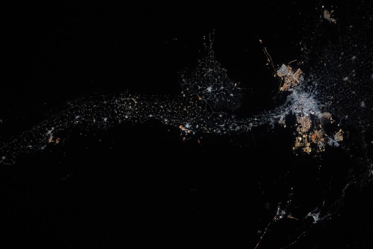
- An astronaut aboard the International Space Station (ISS) captured a night-time view of Egypt’s Nile River glowing with urban lights.
- the photograph highlights urban advancement along the riverbanks,from Minya to New Bani Sewf City,ending at Cairo in the Nile delta.
- The Nile River, spanning 4,130 miles (6,650 kilometers), is historically significant for enabling agriculture and supporting Ancient Egyptian civilization.
- The image was taken from low Earth orbit at an altitude of approximately 259 miles (417 kilometers).
Image:
!Photo of Egypt’s Nile river from space
[Photo credit: NASA]
Indian Opinion Analysis
India’s own history has been deeply intertwined with river systems like the Ganga, Yamuna, and Brahmaputra in ways comparable to Egypt’s reliance on the Nile.These rivers have been lifelines for agriculture, culture, and urban development over millennia. A photograph such as this underscores how human settlement clusters around water sources globally due to their life-sustaining properties.
For India-where rivers play a similar pivotal role-the visible urbanization along water sources raises considerations about enduring river basin management amid rapid population growth and industrial expansion. Much like photographs tracking changes in Nile-related developments over time through space imagery shed insights into environmental dynamics or demographic shifts in Egypt, such tools could likewise bolster India’s efforts to map its water networks for policymaking.
The comparison highlights shared challenges between developing nations whose histories are tied closely to their rivers while emphasizing innovations like satellite imaging as critical tools for shaping future planning strategies.


