


Now Reading: Japan’s Supervolcanic Caldera with 17 Volcanoes Captured from Space
-
01
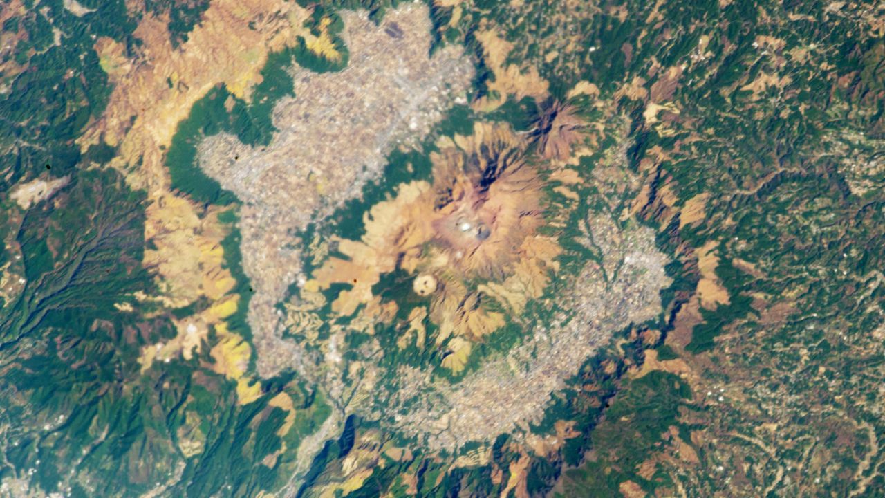
Japan’s Supervolcanic Caldera with 17 Volcanoes Captured from Space
Swift Summary
- location: Aso caldera, Japan, in the heart of Kyushu Island.
- Description: A massive caldera, 24 kilometers (15 miles) across, formed by four major pyroclastic eruptions between 300,000 and 90,000 years ago.
- Volcanoes: Contains 17 volcanoes; five main peaks (Aso Gogaku) exceed the height of the outer ridge. Nakadake is the most active and last erupted in October 2021.
- magma Source: A large magma chamber located ~6 km below surface feeds its active volcanoes.
- Human Activity: Today houses urban regions, agricultural infrastructure, and hot springs like Jigoku (“hell”). It previously contained ancient lakes drained by natural rivers.
- Geological Significance: Classified as one of Earth’s nine “supervolcanoes.” Its explosive history included level-8 eruptions that spread ash up to Hokkaido (~900 miles away). Located on Pacific Ring of Fire at tectonic convergence zones.
Indian Opinion Analysis
The depiction of Japan’s Aso Caldera underscores both geological marvels and hazards pertinent to nations bordering tectonic fault lines such as India. While India does not host supervolcano structures like those described here owing to its unique plate geography, understanding systems like Kyushu’s reinforces preparedness against seismic vulnerabilities stemming from India’s proximity to the Himalayan orogenic boundary.
The article further illustrates how lasting habitation thrives despite volcanic histories-a promising model for optimal land use within geologically dynamic contexts globally. For India’s growing urbanization near hazardous terrains (e.g., Deccan Traps or Andaman trench zones), lessons from structured risk assessments in regions like Aso could be insightful for integrating conservation with resilience-focused infrastructure governance.Read More


Related Posts
Stay Informed With the Latest & Most Important News
Previous Post
Next Post


Advertisement


