

Now Reading: Major U.S. Cities Like Denver and Dallas Slowly Sinking, Study Shows
-
01
Major U.S. Cities Like Denver and Dallas Slowly Sinking, Study Shows
Swift Summary
- Research Findings: The 28 most populous cities in the U.S. are sinking, increasing risks of flooding and infrastructure damage. Over 20% of each cityS area is sinking, with rates exceeding 2 millimeters per year for several cities.
- Highest Rates: Houston, Fort Worth, and Dallas show subsidence rates above 4 mm per year; parts of Houston sink faster then 10 mm annually.
- Main Cause: Groundwater extraction accounts for 80% of the sinking observed across these cities.
- Infrastructure Risks: Subsidence impacts include uneven ground deformation leading to tilting buildings and potential collapses. Approximately 29,000 buildings are flagged as being in critical zones.
- flooding Concerns: Uneven subsidence can create “subsidence bowls,” trapping water and exacerbating flooding events during rainfall or storms.
- Technology Used: Satellite measurements via interferometric synthetic aperture radar (InSAR) provided granular data on vertical land movement across urban areas.
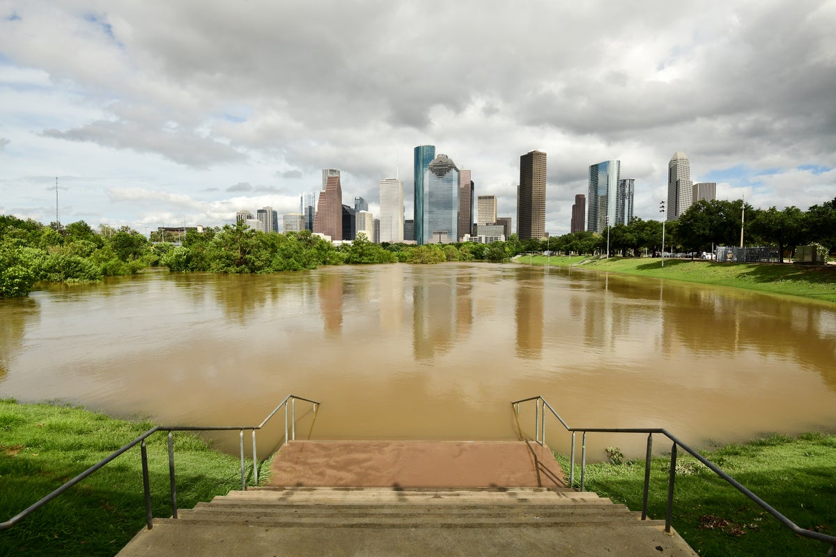
[Photo caption]: Flooding after Hurricane Beryl in Buffalo Bayou park in Houston, texas (July 2024).
Indian Opinion Analysis
The study underscores the importance of proactive urban planning globally-not just limited to coastal regions typically at risk from subsidence. Groundwater extraction is revealed as a critical component fueling this issue; hence lasting management practices must align with developmental needs to mitigate potential catastrophes.
For India, where rapid urbanization is similarly reliant on groundwater resources, lessons from this research could be pertinent. Rising subsurface vulnerabilities might parallel challenges faced by populous Indian cities like Delhi or Bengaluru-regions already grappling with water scarcity alongside infrastructural stressors such as flood control systems or building foundations.
India should prioritize mapping localized trends through advanced satellite-based technologies like InSAR to preemptively assess risks in its metropolitan hubs while advocating balanced approaches between resource exploitation and environmental conservation targets.


Related Posts


Stay Informed With the Latest & Most Important News
Previous Post
Next Post


Advertisement


