


Now Reading: NASA Backs Technology to Tackle Wildfires
1
-
01
NASA Backs Technology to Tackle Wildfires
fast Summary
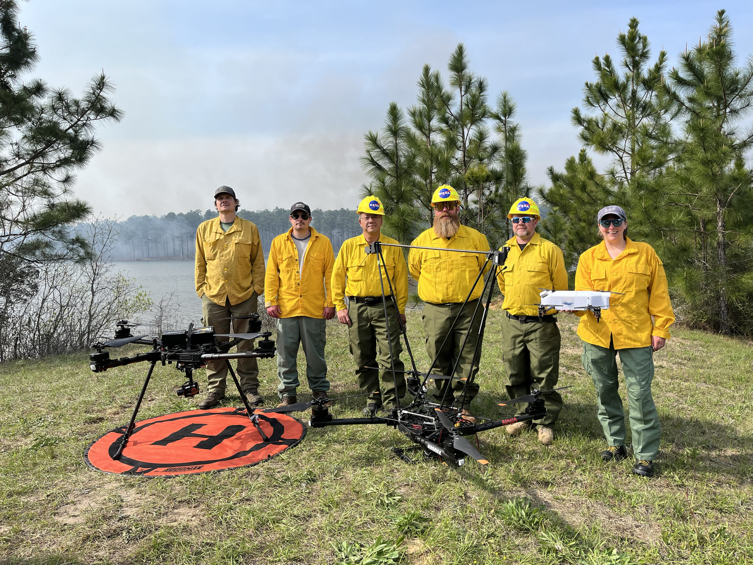
- NASA Armstrong Flight Research Center is advancing airborne technology to gather localized wind,temperature,and humidity data in wildland fire areas.
- During a prescribed burn in Alabama’s Geneva State Forest (March 25), the Alta X drone equipped with specialized sensors provided data on variables like mixing height, moisture levels, and smoke dispersion.
- Additional aircraft like NASA’s B200 King Air supported data collection at varying altitudes for forecast modeling refinement; testing aligns with the FireSense project goals.
- Research aims to provide better tools for wildland firefighting agencies to predict behavior of fires and improve firefighter resource allocation and decision-making.
- Alta X drones fly autonomously and vertically up to 3,000 feet, observing changes throughout the day with precise measurements. Past testing was performed in Montana (August 2024).
Indian Opinion Analysis
The development of highly accurate airborne technology for assessing meteorological variables connected to fires holds meaning globally but also has potential relevance for India given its own challenges with forest fires annually.If successfully integrated into fire-prone regions like those faced in Uttarakhand or Himachal Pradesh forests during peak dry seasons here-the lessons from projects such NASA FireSense could grate template adapted policy / replicable ideas bring capabilities reduce wildfire -related damages environmental/socio-econ


Related Posts

Stay Informed With the Latest & Most Important News
Previous Post
Next Post
Donations


Advertisement

Loading Next Post...


