


Now Reading: NASA’s Cutting-Edge Radar to Monitor Quakes, Landslides, and Ice Loss from Space
1
-
01
NASA’s Cutting-Edge Radar to Monitor Quakes, Landslides, and Ice Loss from Space
NASA’s Cutting-Edge Radar to Monitor Quakes, Landslides, and Ice Loss from Space
Rapid Summary
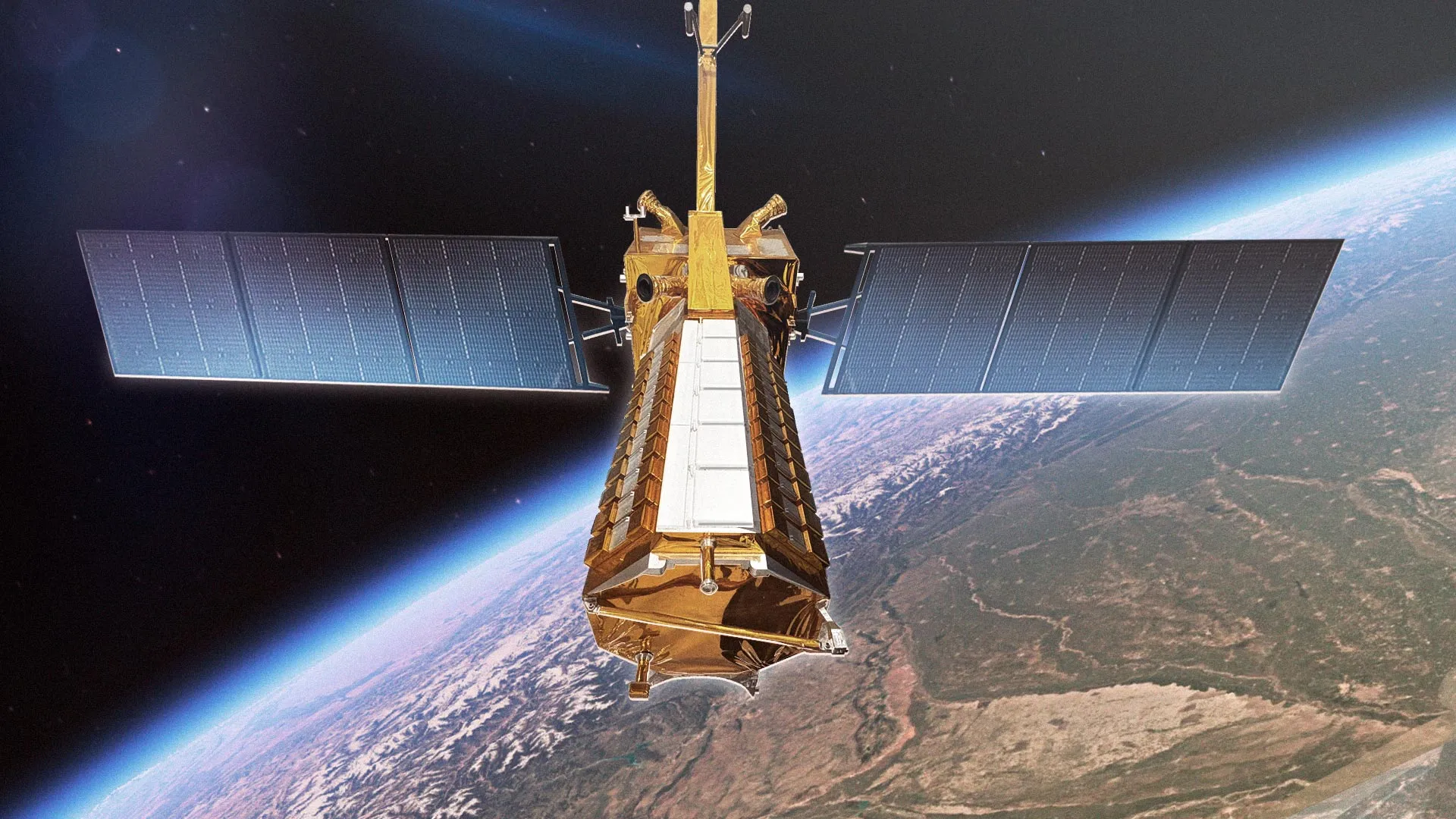
- NISAR satellite, a joint mission by NASA and ISRO, launched on July 30.
- It will orbit Earth for at least three years, scanning nearly all land and ice surfaces twice every 12 days.
- Mission focuses on studying natural hazards like earthquakes, volcanic eruptions, landslides, and weather disasters such as hurricanes and flooding.
- Data will aid monitoring of infrastructure (e.g.,dams,bridges) and provide insights into Earth’s carbon cycle impacts from deforestation,fires,permafrost loss.
- First-ever hardware collaboration between NASA and ISRO on Earth observation; combines L-band radar (25 cm wavelength) with S-band radar (10 cm wavelength).
- Dual radars will capture synchronized data too measure soil moisture levels or detect surface deformation/movement accurately.
- Satellite offers unprecedented coverage of the Antarctic ice sheet to study its motion, deformation, melting process affecting ocean water levels.
Read more: ScienceDaily Article
Indian Opinion Analysis
The NISAR mission signifies a landmark moment in global scientific collaboration between India and the United States while showcasing cutting-edge engineering innovation by both nations’ space agencies-NASA and ISRO. By addressing key areas such as disaster response capabilities, environmental monitoring through synchronized radar systems offering unmatched precision on surface measurements globally-including India’s own diverse terrain-it could significantly enhance policymaking related to climate resilience strategies at home too skill alignment partnerships show mutual values but data importance matching outcomes broader sphere regional internationally necessities


Related Posts
Stay Informed With the Latest & Most Important News
Previous Post
Next Post

Donations


Advertisement

Loading Next Post...


