
Now Reading: New Orleans Faces Crisis as $15 Billion Flood Defenses Sink
-
01
New Orleans Faces Crisis as $15 Billion Flood Defenses Sink
Speedy Summary
- Study Focus: Researchers at Tulane university studied land subsidence in new Orleans using satellite radar data from 2002 to 2020.
- Key Findings:
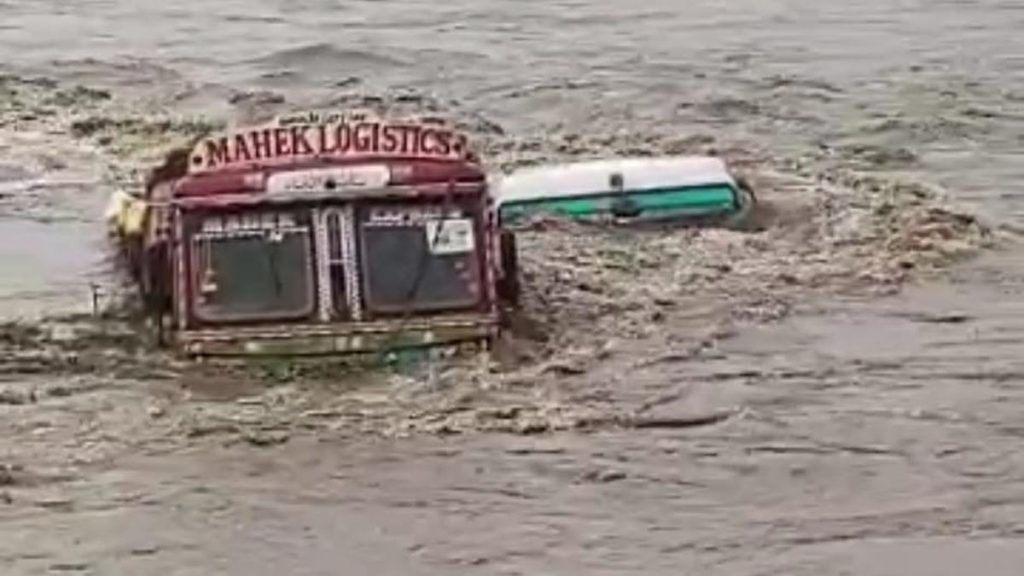
– Some areas, including floodwalls, wetlands, and neighborhoods, are sinking by over an inch per year; some up to nearly two inches annually.
– Causes include natural soil compaction, groundwater pumping, industrial progress, and wetland drainage.
- Flood Risk:
– Sections of the $15 billion post-Katrina Hurricane and Storm Damage Risk Reduction System (HSDRRS) are sinking faster than sea level rise in certain areas, reducing their effectiveness against storm surges.
- Wetlands impact: Rapid sinking of wetlands east of New Orleans may lead to marshes turning into open water within a decade. Wetlands aid in storm surge buffering.
- Satellite Technology Used: InSAR methodology provided precise millimeter-scale elevation tracking over time for a detailed map of vertical land motion.
- Expert Remarks:
– Regular monitoring and maintenance are needed for flood defenses like levees and concrete floodwalls to sustain protection levels.
– Changes aren’t uniform; targeted reinforcement planning is necessary.
Indian opinion Analysis
The study underscores the urgent need for proactive infrastructure management in regions prone to subsidence. For India-a nation with vast coastal cities vulnerable to similar challenges-it offers crucial lessons about leveraging advanced technologies like satellite-based monitoring to assess risks from ground elevation changes. The findings emphasize that planning must account not only for sea-level rise but also localized environmental shifts such as soil degradation or rapid urban expansion.
Investing in early detection systems can mitigate long-term hazards while preserving crucial ecosystems like wetlands that provide both ecological benefits and natural disaster buffers. India’s own experience with monsoons suggests that maintaining the integrity of drainage systems alongside strategic urban development will ensure resilience against flooding risks exacerbated by climate change-driven events.Read More


Related Posts
Stay Informed With the Latest & Most Important News
Previous Post
Next Post


Advertisement


