
Now Reading: PRISM Wins Entrepreneurs Challenge, Harnesses AI for Geospatial Insights
-
01
PRISM Wins Entrepreneurs Challenge, Harnesses AI for Geospatial Insights
Quick Summary
- NASA Entrepreneurs Challenge: Initiated in 2020, 2021, adn 2023 to support innovative technologies aligned with NASA’s science goals. Venture capital was involved to leverage external funding sources, awarding a total of $1M in prize money in 2023.
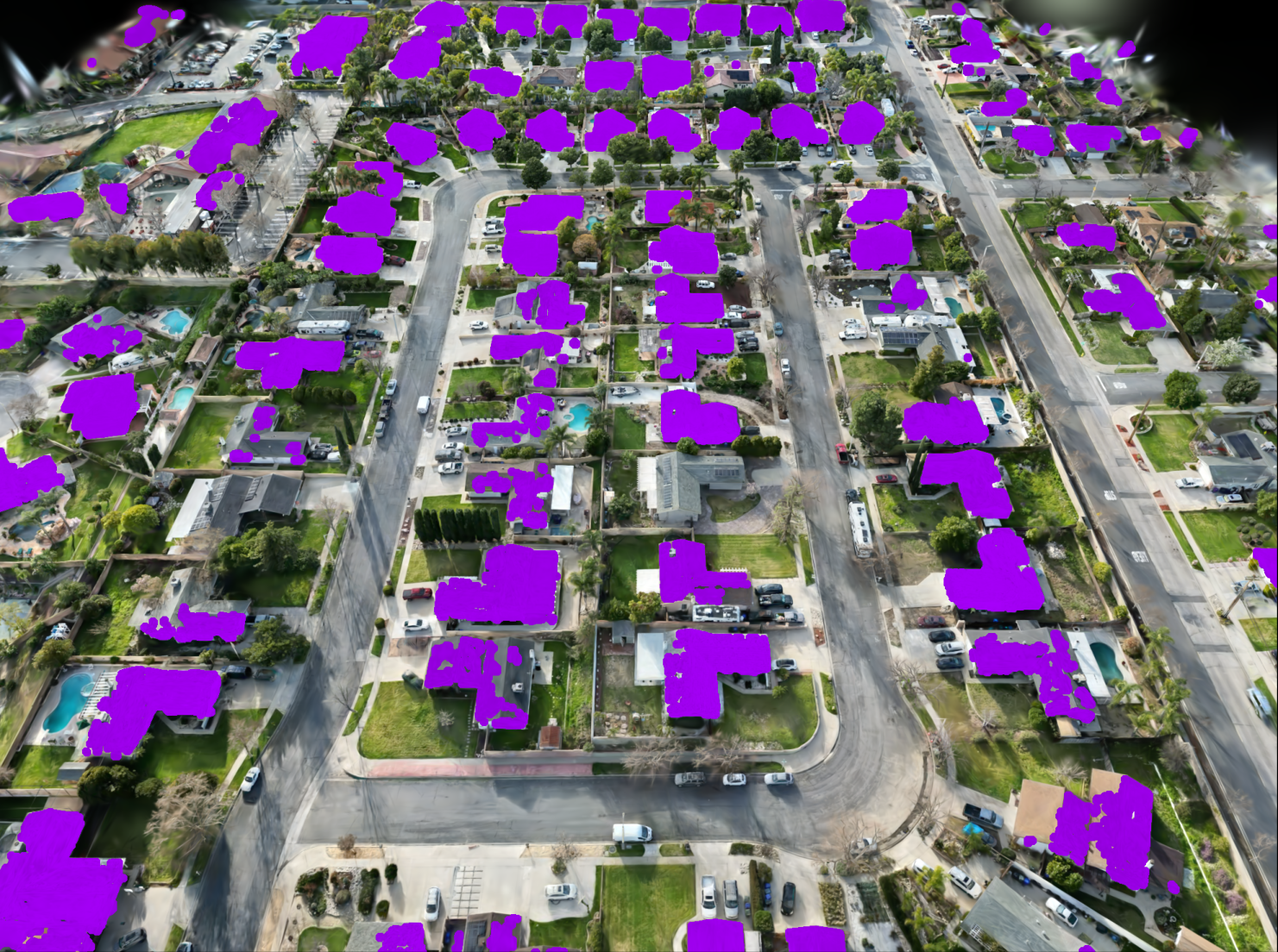
- Challenge Winner Spotlight: PRISM Intelligence (formerly Pegasus Intelligence and Space) won the event. Their platform transforms geospatial data into queryable digital environments using AI and computer vision technology.
- PRISM Technology:
– Converts raw remote sensing data into dynamic 3D visualizations using radiance fields, AI segmentation, and machine learning.
– Usability-focused design allows users to interact with geospatial data via natural-language queries without prior GIS expertise.
– Applications range from property appraisals and city maintenance to ecosystem studies.
- Goals & Expansion:
– Current focus on creating high-resolution digital twins of select areas using proprietary aerial imagery.
– Plans to integrate NASA Earth science data for expanded coverage over larger regions with detailed multiband imagery.
Indian Opinion Analysis
The efforts by PRISM Intelligence signify an emergent shift toward democratizing access to advanced geospatial intelligence through simplified interfaces powered by AI. While traditionally such technologies have been exclusive tools for governments or specialized industries reliant on complex GIS systems, platforms like PRISM appear poised to broaden usage across common sectors such as urban planning, infrastructure management, environmental research, insurance services-and even entrepreneurial scenarios like gardening or pool cleaning.
For India-a country managing urban sprawl alongside significant rural areas-innovative geospatial solutions could offer immense utility in governance and resource allocations. Efficient mapping techniques integrated with local datasets could enhance agricultural monitoring processes or support rapid-response damage assessments during climate-related disasters.
Moreover, integration of real-time insights may align well with india’s “Digital India” mission aimed at leveraging technology for inclusive development. However, triumphant implementation would require addressing challenges around technological adoption costs while ensuring compatibility between local datasets and advanced digital platforms like PRISM’s framework. Neutral collaboration between public institutions and private startups remains critical for success.


Related Posts


Stay Informed With the Latest & Most Important News
Previous Post
Next Post


Advertisement


