


Now Reading: Quiet Chernobyl’: Earth’s Mantle Still Shifting 80 Years On
-
01
Quiet Chernobyl’: Earth’s Mantle Still Shifting 80 Years On

Quick Summary
- Earth’s mantle beneath Central Asia’s Aral Sea is bulging due to water loss over the past 80 years,according to new research published in nature Geoscience.
- The Aral Sea, once the fourth-largest lake globally, suffered extensive desiccation beginning in the 1960s after two rivers were diverted for irrigation and severe drought further impacted its water levels.
- Over time, the lake lost 1.1 billion metric tons of water (equivalent to the mass of 150 Great Pyramids of Giza), causing Earth’s crust to rebound substantially.
- Satellite analysis using interferometric synthetic aperture radar (InSAR) between 2016 and 2020 revealed land bulging across a radius of approximately 500 kilometers around the former lake’s center.
- The region has risen by an average height of about 7 millimeters annually during that period and experienced a total uplift of nearly 40 mm.
- Scientists attribute this phenomenon to mantle dynamics where rocks flow into regions with reduced surface weight. similar processes occurred after ice sheets melted in Scandinavia following the last ice age.
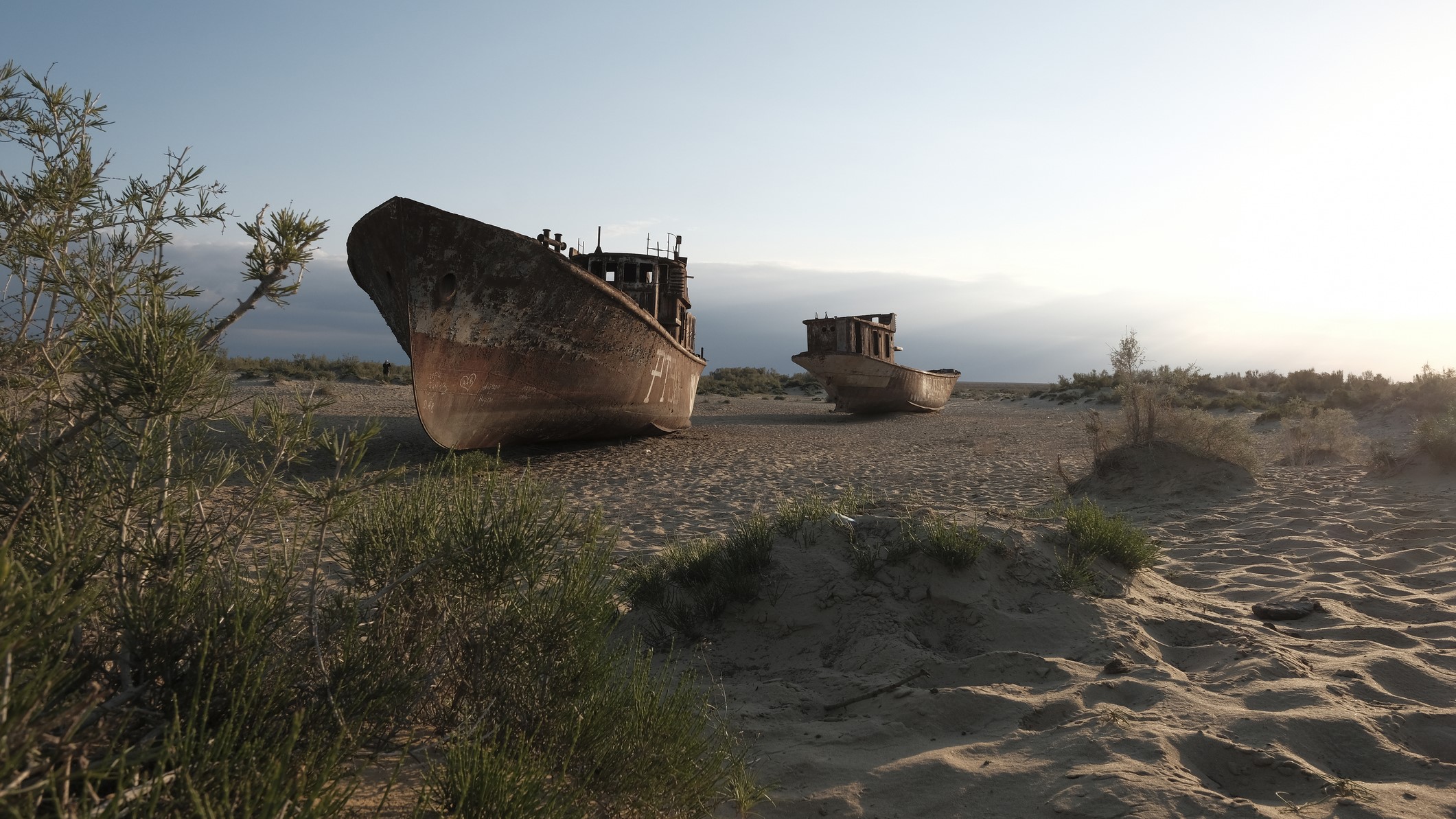
- desertification and ecological degradation caused by human activities have left behind barren landscapes peppered with rusting ships where the aral Sea once existed.
!Aral Sea satellite images
Images show progressive desiccation from left: year 2000 (far-left), year 2007 (center), year 2014 (far-right). credits: NASA Earth Observatory.
!Desert with stranded ships
Former sea area turned desert shows abandoned ships as relics. Credits: Eddie Gerald/Getty Images.
Indian Opinion Analysis
The environmental disaster that led to drastic changes in Earth’s crust around uzbekistan’s and Kazakhstan’s borders holds significant cautionary lessons for nations like India. as one of Earth’s fastest-growing economies reliant on vast agricultural irrigation networks, India faces risks associated with mismanagement or overexploitation of natural resources such as rivers.
The case reinforces how human activity-including river diversion-can irreversibly alter not just local ecosystems but also deep-earth geological dynamics over decades or more. This poses questions about India’s existing systems managing its critical waterways such as Ganga-Brahmaputra basins amidst climate challenges like droughts or water misuse.
Furthermore, scientific advancements like satellite sensing demonstrated here emphasize India’s need for similar technological investments to track environmental impacts proactively. While resilience measures-such as improved irrigation technologies-are crucial economically, they must factor sustainable long-term resource conservation alongside regional political partnerships safeguarding transboundary waters shared internationally within South Asia.
The Aral Sea example serves as both a stark warning and an opportunity for countries navigating development paths intricately tied with thier natural resource handling strategies.


Stay Informed With the Latest & Most Important News
Previous Post
Next Post


Advertisement


