

Now Reading: Saharan Dust Plume Sweeps Across Africa, Heads Toward Florida
1
-
01
Saharan Dust Plume Sweeps Across Africa, Heads Toward Florida
Rapid Summary
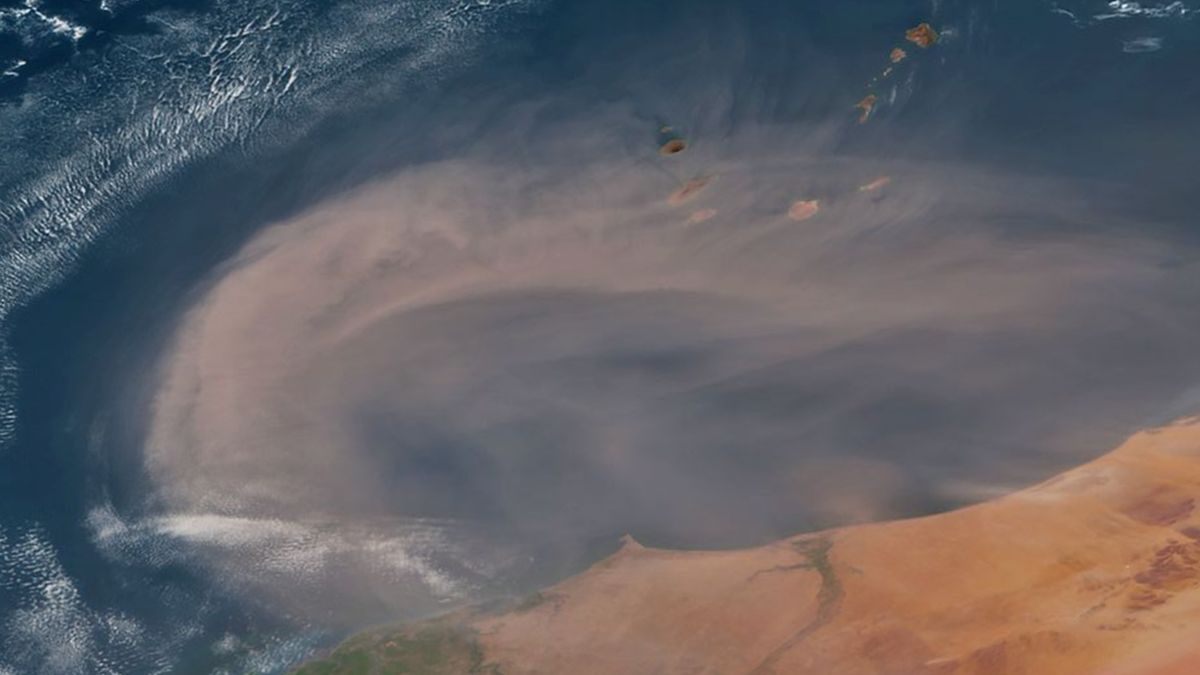
- Event: A massive Saharan dust plume originated from the Sahara Desert on May 28, 2025, and traveled across the Atlantic Ocean.
- Trajectory: the dust cloud traversed approximately 4,000 miles (6,500 kilometers), reaching Florida and other Gulf Coast states by June 4. It also impacted Caribbean countries such as Puerto Rico and the Bahamas during its journey.
- Satellite Capture: The GOES-19 satellite captured a detailed image of the plume when it spanned an area of around 240,000 square miles (620,000 km²) near Cabo Verde and west Africa’s coastline. Subsequent dispersion made it appear larger in size.
- Local Impact in Florida: Brief air quality reductions were reported as skies remained hazy for around two days. Dust was visible on windows and cars.
- saharan Air Layer Mechanism: Strong winds in late spring frequently lift desert dust into a dry atmospheric layer hovering above Sahara at around 1 mile altitude before dispersing across oceans every 3-5 days.
- Historical Context: Saharan plumes routinely reach North America between June-August annually; notable instances include the “Godzilla” event of June 2020.
Indian Opinion Analysis
The transatlantic movement of Saharan dust underlines global interconnectedness within meteorological systems. While distant events like these seemingly have no direct impact on India’s environment, they are poignant reminders that climate phenomena are not constrained by national boundaries-emphasizing India’s role within international climate action frameworks.Historically facing its own challenges with desertification and airborne particulate pollution (e.g., Thar Desert), India can leverage global studies like this for improved atmospheric modeling and disaster preparedness strategies while contributing to collective solutions for monitoring such natural phenomena.Read More


Related Posts


Stay Informed With the Latest & Most Important News
Previous Post
Next Post


Donations


Advertisement

Loading Next Post...


