

Now Reading: Telangana Issues Heavy Rainfall Alert for 4 Districts Until September 2
-
01
Telangana Issues Heavy Rainfall Alert for 4 Districts Until September 2
Quick Summary
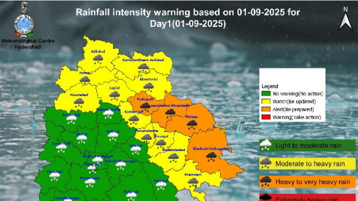
- India Meteorological Department (IMD) has issued orange alerts for four districts of Telangana: Bhadradri Kothagudem, Jayashankar Bhupalpally, Mulugu, and Peddapalli.
- Heavy to very heavy rainfall is expected in these areas from Monday afternoon (Sep 1, 2025) to Tuesday morning.
- Isolated heavy rainfall is forecasted in 11 additional districts, including Adilabad, Hanumakonda, Jagtial, Karimnagar, and Warangal. Hyderabad may experience light to moderate rain with gusty winds (30-40 kmph).
- A fresh monsoon low is likely to form in the Northwest Bay of Bengal within the next 12-36 hours per IMD.Northern parts of Telangana could face flooding risks from the Godavari River and its tributaries due to widespread rains. The highest recorded rainfall so far was 36.8 mm in Medak until Monday afternoon.
- Orange alert extends into Tuesday morning for seven more districts as heavy rain remains likely through Wednesday.
Indian Opinion Analysis
Heavy monsoon activity over Telangana reflects a recurring climate pattern that emphasizes India’s vulnerability during peak monsoon months. While orange alerts guide disaster preparedness by flagging potential flood risks-especially where major rivers like the Godavari flow-they also highlight gaps requiring attention like infrastructure resilience in vulnerable zones such as North telangana’s lowlands adjoining central India.
The formation of another fresh low-pressure zone off the Bay raises questions about how effectively states coordinate early warning systems across borders when rivers span multiple regions. Rainfall data points such as Medak’s modest peak today suggest localized impacts can vary widely despite statewide warnings-a reminder that granular monitoring matters alongside broad alerts.
Read More: Link


Related Posts
Stay Informed With the Latest & Most Important News
Previous Post
Next Post


Advertisement


