





















Now Reading: Cyclone Arnab leaves 3 dead, 714 villages hit in Andhra landfall
-
01
Cyclone Arnab leaves 3 dead, 714 villages hit in Andhra landfall


The Story in Brief
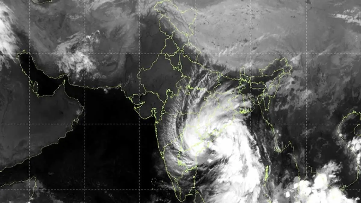
Cyclone Arnab completed landfall on the Andhra Pradesh and Yanam coast on Wednesday, 28 October, with sustained wind speeds of 125 to 135 km/h and gusts reaching 150 km/h. The storm’s centre crossed the coast between 2:00 am and 8:00 am, located about 20 km east-northeast of Narasapur, 40 km southwest of Yanam and 60 km southwest of Kakinada. The India Meteorological Department said the centre has now moved inland.
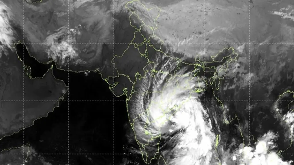
After crossing the coast, the cyclone weakens as it loses warm ocean moisture, but the danger is not over. The INSAT-3DS weather satellite image taken between 9:30 am and 9:57 am shows the cyclone’s cloud bands spread over wide areas of eastern and southern India and the Bay of Bengal. Officials said this does not mean all those areas will see a direct storm impact, but heavy rain, waterlogging and flooding remain possible away from the coast. The IMD is tracking the cyclone’s inland direction to assess which districts will receive the heaviest rainfall.
Indian Opinion Analysis
Cyclone Arnab has made landfall and moved inland, but the satellite image shows its cloud cover is far wider than the centre. The INSAT-3DS picture reveals dense cloud bands stretching across large parts of eastern and southern India, even areas far from the coast. This means heavy rain, waterlogging and local flooding are possible well beyond the landfall zone, even as the cyclone weakens. The India Meteorological Department will now track the cyclone’s path inland to forecast which districts get the heaviest rain. The immediate next step is for residents of Andhra Pradesh and neighbouring regions to heed weather warnings, as the threat of falling trees and snapping power lines persists after landfall.
Source: aajtak.in
This brief was synthesised by AI from the source linked above. Methodology and corrections.