

















Now Reading: Haryana to get light rain from Oct 7 as western disturbances approach
-
01
Haryana to get light rain from Oct 7 as western disturbances approach



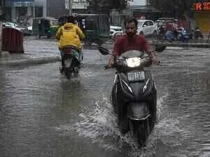
Haryana is likely to see a change in weather from 7 October under the influence of two consecutive western disturbances, with light rain and thunderstorms expected in parts of the state. The weather systems are expected to bring down temperatures, providing relief from the prevailing above-normal heat.
Madan Khichar, head of the agricultural meteorology department at Chaudhary Charan Singh Haryana Agricultural University, said day temperatures had remained 3 to 4°C above normal and night temperatures 2 to 3°C above normal over the past four to five days due to dry westerly winds.
The first western disturbance is likely to move towards the hills on 7 October. Northern Haryana may receive light rain, gusty winds and isolated thunderstorms from the night of 7 October to 9 October. A second western disturbance is expected from 9 October, with most parts seeing partly cloudy skies and isolated light rain from 10 to 12 October. After 12 October, conditions are expected to turn dry again.
Indian Opinion Analysis
The forecast of two western disturbances in quick succession offers a clear window of relief for Haryana, where day and night temperatures have been running 2 to 4°C above normal for nearly a week. The timing matters: the rain and cloud cover from 7 to 12 October will cool both soil and air ahead of the rabi sowing season, but the return of dry northwesterly winds after 12 October means the respite is temporary. Farmers and district officials will watch whether the first system delivers meaningful rainfall to northern districts or remains a patchy drizzle event across the rest of the state.
Source: timesofindia.indiatimes.com
This brief was synthesised by AI from the source linked above. Methodology and corrections.