















Now Reading: India and Nepal to use drones to map Dasgaja encroachments
-
01
India and Nepal to use drones to map Dasgaja encroachments


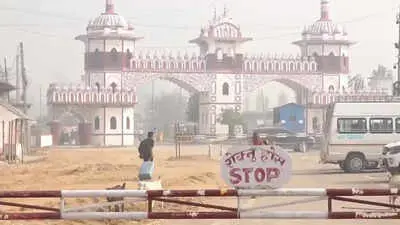
India and Nepal have agreed to deploy drones to map encroachments along the 'Dasgaja', the 10-yard no-man's strip along the 1,880km open border. The two countries will also map 'cross-border occupation', where citizens of one nation farm, live on or hold land on the other side. The decision was taken at the 13th meeting of the Survey Officials Committee, led by deputy chiefs of Nepal's Survey Department and Survey of India, in Lucknow last week.
The exercise aims to create a jointly verified technical record of affected areas, which can later help negotiate removal of encroachments, restoration of land, or compensation. The issue returned to Nepal's political centre stage in May after Prime Minister Balendra Shah told Parliament that 'Nepal had also encroached on Indian land', triggering opposition protests. Nepal's foreign ministry later clarified that Shah was referring to Dasgaja encroachments and cross-border occupation, not territorial claims over Kalapani, Lipulekh, or Limpiyadhura.
Nepal Survey Department spokesperson Dayanand Joshi confirmed the drone mapping decision. Former Survey Department director general Buddhi Narayan Shrestha said his 2005 field study found Indian farmers occupying Nepali land at 84 locations and Nepali farmers occupying Indian land at 27 locations. He noted that nearly 42 per cent of the 8,553 border pillars shown on maps are yet to be installed, making drone mapping crucial for preventing village-level disputes from turning into diplomatic flashpoints.
Indian Opinion Analysis
The Dasgaja strip is a legacy of the 1816 Sugauli Treaty between the British East India Company and Nepal. With no fences and sparse pillars along much of the 1,880km border, local land records often overlap, and farmers on both sides till fields that technically belong to the other country. Drone mapping will create a single, jointly verified record, which could settle hundreds of small-scale disputes that strain local relations. The next step will be for technicians from both sides to compile the data, after which higher-level officials will negotiate removal, restoration, or compensation. How the two governments handle those negotiations, especially with Nepal's domestic politics sensitive to territorial issues, will determine whether this technical fix translates into lasting resolution.
Source: timesofindia.indiatimes.com
This story was synthesised by AI from the source linked above. Methodology and corrections.