
















Now Reading: Asia water tower loses 24 billion tonnes groundwater yearly
-
01
Asia water tower loses 24 billion tonnes groundwater yearly


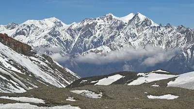
A new satellite-based study has found that groundwater reserves beneath High Mountain Asia, known as the 'Asian water tower', are depleting by about 24.2 billion tonnes annually. The research, led by Prof. Shudong Wang of the Chinese Academy of Science and published in Environmental Research Letters, used an AI-powered model combining satellite observations, earth system modelling, and explainable AI to reconstruct 20 years of groundwater storage changes across the region.
The study found that roughly two-thirds of High Mountain Asia experienced declining groundwater storage between 2003 and 2020. The largest losses were in heavily populated downstream basins like the Ganges-Brahmaputra, Indus, and Amu Darya, where irrigation demand is high. Climate factors explain nearly half the variation in groundwater storage, with human water withdrawals becoming an increasingly significant source of depletion, especially after 2010.
Researchers project that if current water use patterns continue, groundwater losses will accelerate. While increased glacier melt could temporarily slow the decline around the 2060s, this buffer effect is expected to be followed by faster losses, threatening agricultural areas downstream that depend on these reserves.
Indian Opinion Analysis
The 'Asian water tower' feeds rivers that support over a billion people across India, China, Pakistan, and other nations. The Ganges-Brahmaputra basin alone accounts for a huge share of India's irrigation and drinking water. The study's finding that human withdrawals became more pronounced after 2010 aligns with rapid groundwater exploitation in northern India for wheat and rice farming. What matters next is whether countries sharing these basins can coordinate monitoring and limits. The next step is for governments to use such satellite data to set sustainable extraction caps before the buffer from glacier melt runs out.
Source: timesofindia.indiatimes.com
This story was synthesised by AI from the source linked above. Methodology and corrections.