










Now Reading: Cyclone Murasu 420 km from Chennai, 10 states on alert
-
01
Cyclone Murasu 420 km from Chennai, 10 states on alert



The Story in Brief
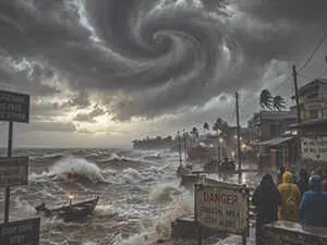
Cyclonic storm 'Murasu' over the Bay of Bengal has intensified into a severe cyclonic storm and is moving towards the Andhra Pradesh coast. As of Monday, 2 November, it was located 420 km from Chennai (per bhaskar.com) or 260 km from Chennai (per TV9 Hindi), with the storm expected to cross the southern Andhra coast between Nellore and Narsapur between 2 November 11:30 PM and 3 November 4 AM.
The India Meteorological Department (IMD) has issued alerts across 10 states: Andhra Pradesh, Telangana, Tamil Nadu, Arunachal Pradesh, Kerala, Karnataka, Maharashtra's Vidarbha, east Madhya Pradesh, Odisha and Chhattisgarh. Wind speeds are predicted to reach 100 to 110 km/h, with gusts up to 120 km/h. Evacuations from coastal areas have begun in Andhra Pradesh and southern Odisha. In Raigada district, the administration has deployed all 11 fire stations' teams and heavy machinery on National Highway 326 for emergency clearance, following a virtual review meeting on Sunday, 1 November.
Indian Opinion Analysis
Both sources provide straight factual coverage of Cyclone Murasu, with no discernible editorial slant. Bhaskar.com leads with the distance from Chennai (420 km) and lists 10 affected states, while TV9 Hindi emphasises the cyclone's intensification and provides precise landfall timing (2 November 11:30 PM to 3 November 4 AM) and wind speeds (100 to 110 km/h, gusts to 120 km/h). TV9 Hindi also includes district-level preparedness details from the Raigada administration, such as deployment of 11 fire station teams and equipment on National Highway 326. The uniform wire-service style offers a balanced picture of the cyclone's trajectory and administrative response. The cyclone is expected to cross the Andhra coast between Nellore and Narsapur early on 3 November.
Coverage: 2 sources, 2 neutral
Sources (2): bhaskar.com (neutral report), tv9hindi.com (neutral report)
This brief was synthesised by AI from the 2 sources linked above, so one read covers every framing they carry. Methodology and corrections.