



















Now Reading: IIT Bombay AI decodes satellite images with plain language prompts
-
01
IIT Bombay AI decodes satellite images with plain language prompts


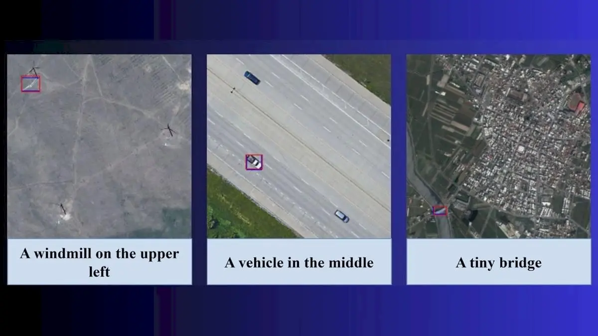
Researchers at IIT Bombay have developed an artificial intelligence model that can interpret satellite and drone images using everyday language. The model, called Adaptive Modality-guided Visual Grounding (AMVG), was created by a team led by Professor Biplab Banerjee.
Users can give prompts like "find all damaged buildings near the flooded river" and get results in minutes. The system uses a Multi-stage Tokenised Encoder and Attention Alignment Loss, which acts like a virtual coach to help the machine focus on relevant image regions, said lead author and PhD researcher Shabnam Choudhury.
The team envisions applications in disaster response, surveillance, urban planning, and agriculture. Professor Banerjee said AMVG has not yet been tested in real-world disaster scenarios, but collaborations with ISRO are likely to start shortly. The researchers have open-sourced the AMVG code on GitHub to encourage transparency.
Source: thehindu.com
This story was synthesised by AI from the source linked above. Methodology and corrections.