



















Now Reading: Study projects higher landslide risk across Karnataka’s Western Ghats
-
01
Study projects higher landslide risk across Karnataka’s Western Ghats


A study published in Scientific Reports projects a sharp rise in landslide susceptibility and risk across Karnataka’s Western Ghats by 2050. It examined about 45,000 sq km across seven districts, using machine…
The Story in Brief
A study published in Scientific Reports projects a sharp rise in landslide susceptibility and risk across Karnataka’s Western Ghats by 2050. It examined about 45,000 sq km across seven districts, using machine learning to combine projected rainfall and land-use changes under four climate scenarios. The biggest increases are expected near transport corridors and populated areas in Uttara Kannada, Kodagu and Chikkamagaluru.
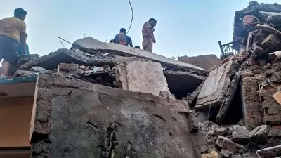
The Deccan Herald reports that three people, including a three-year-old child, died in a recent landslide in Shivamogga’s Thirthahalli. Environmentalists said successive state governments have not acted on a 2021 report recommending mitigation measures in 23 vulnerable taluks, including limits on earthmover use and expert review of development work.
The Indian Opinion
The lazy claim that landslides are purely natural ignores the study’s findings on rainfall and land-use change. But blaming every road or construction project without site-specific evidence is just as weak. The practical test is whether Karnataka publishes an action-taken report on the 2021 recommendations and applies safeguards across the identified 23 taluks before the next monsoon.
Sources (2): india.mongabay.com, deccanherald.com
This story was synthesised by AI from the 2 sources linked above.
Updated: this story now draws on 2 sources.